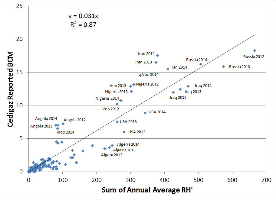
Global Gas Flaring Observed from Space
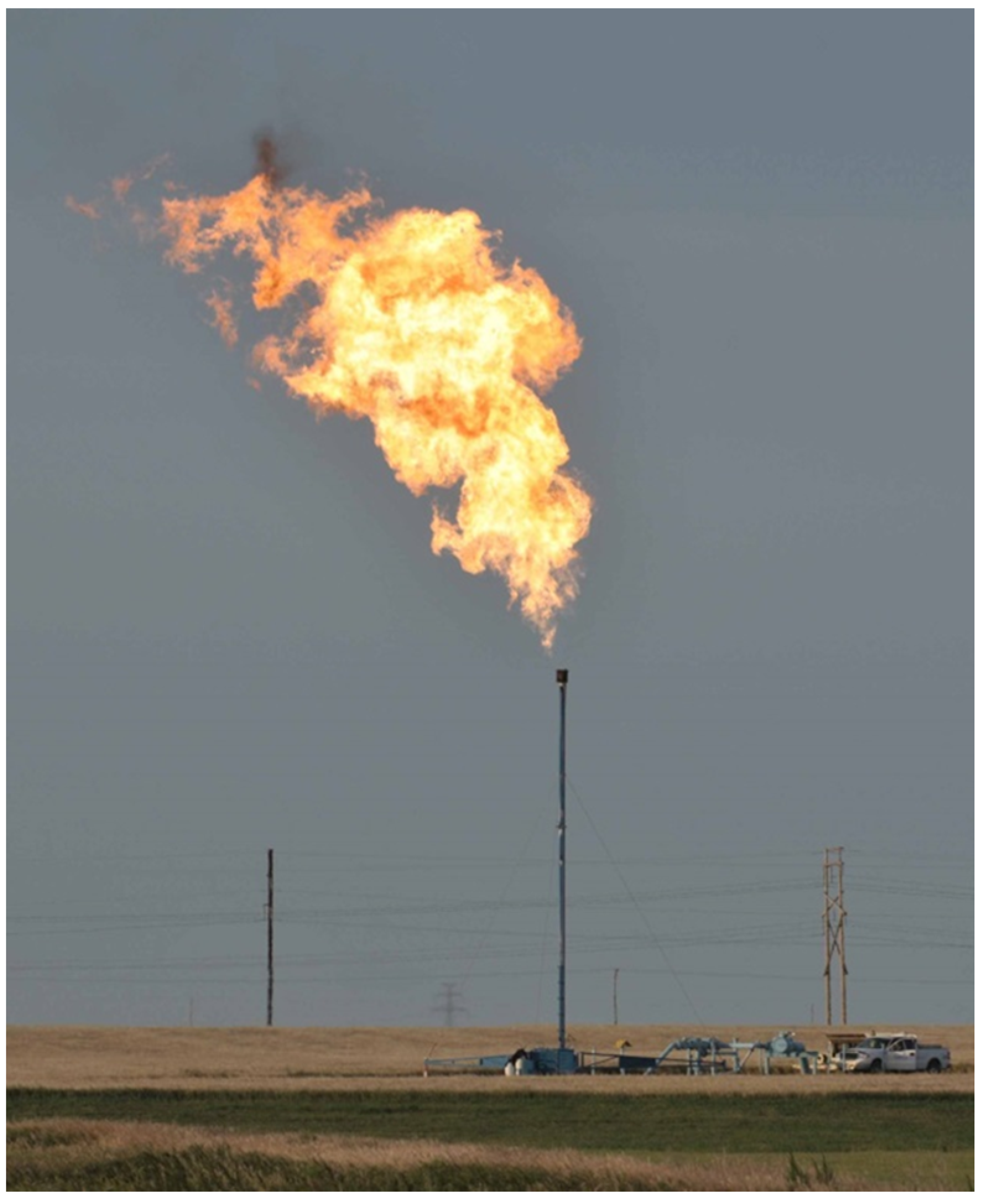
Flaring is widely used to dispose of natural gas produced at oil and gas facilities that lack sufficient infrastructure to capture all of the gas that is produced. The term “associated gas” refers to natural gas that emerges when crude oil is brought to the Earth’s surface. This is the largest source of gas flaring. Smaller quantities of gas flaring occur at oil refineries, natural gas processing facilities, coal mines and landfills. Because flaring is a waste disposal process, there is no systematic reporting of the flaring locations and flared gas volumes. Additionally, where flare volume data are reported, the data are typically self-reported by the flare operators or estimated from the difference between the natural gas volume produced and the quantity used or sold. It is therefore difficult to assess the reliability and accuracy of the reported data. There are four distinct applications for site-specific estimates of flared gas volumes. First, there are carbon cycle analyses that rely on site-specific knowledge of the locations and magnitudes of greenhouse gas emissions to the atmosphere. Second is the tracking of activities to reduce gas flaring. Third is the identification of potentially attractive locations for gas utilization. Fourth is the calculation of the carbon intensity of fuels, such as the California Low Carbon Fuel Standard.
The VIIRS is operated in an unusual way that offers a substantial advantage for the observation of gas flaring. At night, the VIIRS continues to record data in three near- to short-wave infrared channels designed for daytime imaging . With sunlight eliminated, the only features detected in these channels are combustion sources. The SWIR channel, at 1.61 µm, is at the wavelength of peak radiant emissions from gas flares. The 4-µm channel, widely used in satellite fire detection, only detects large flares due to the fact that it falls on the trailing edge of gas flare radiant emissions and observes a mixture of flare plus background radiant emissions. Typically, the flare radiant emissions in the 4-µm channel are about a third of the emissions at 1.65 µm. This has a dramatic effect, limiting the detection of smaller flares in standard satellite fire products based on channels set at the 4 µm wavelength.
We have developed a set of methods for the global survey of natural gas flaring using VIIRS data. The original development was conducted with data from 2012. This has now been expanded to 2013 and 2014. The results below should still be considered preliminary. Updates will be posted as they become available.