Nighttime Lights Posters
Maps have long been used to imagine events occurring on the ground from an airborne perspective. Satellites now record a similar view of actual events for scientists to study. The Defense Meteorological Satellite Program (DMSP) currently operates four satellites carrying the Operational Linescan System (OLS) in low-altitude polar orbits. Three of these satellites record nighttime data. The DMSP-OLS has a unique capability to detect low levels of visible-near infrared (VNIR) radiance at night. With the OLS "VIS" band data it is possible to detect clouds illuminated by moonlight, plus lights from cities, towns, industrial sites, gas flares, and ephemeral events such as fires and lightning-illuminated clouds. The Nighttime Lights of the World data set is compiled from the October 1994 - March 1995 DMSP nighttime data collected when moonlight was low. Using the OLS thermal infrared band, areas containing clouds were removed and the remaining area used in the time series.
The Nighttime Lights of the World poster depicts the lights from cities, fires, gas flares, and fishing boats, each in a separate color. Source data collected October 1994 - March 1995. The poster measures 36.5"x18.76".
The The Changing Nighttime Lights of the World poster depicts the lights from cities, gas flares, fishing boats, the southern aurora, and fires. The data includes the years 1992, 2000, and 2006. Download it here for free.
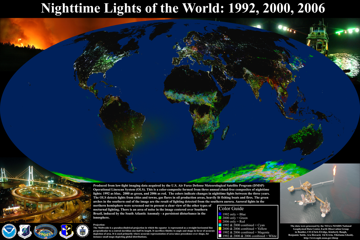
Download the poster for free (111MB) |
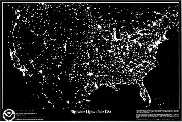
The Nighttime Lights of the USA poster depicts the lights from cities and gas flares (off the coasts of Southern California and Louisiana) in white. Source data collected October 1994 - March 1995. The poster measures 36"x24".
|
The Nighttime Lights of the World poster depicts the lights from cities, fires, gas flares, and fishing boats, each in a separate color. Source data collected October 1994 - March 1995. The poster measures 36.5"x18.76".

Nighttime Lights of the World Poster (Out of Print/Not Available) |