Thailand Study: 14 to 20 North, 97 to 101 East
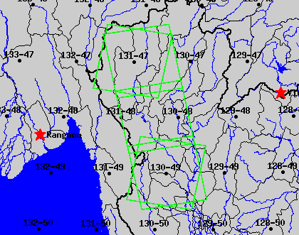 A) Chang Mai Area
Daytime Landsat ETM Path/Row 131/47
2002/02/07 Provided by NASA
2002/03/27 Provided by NASA
Nighttime Landsat ETM Path/Row 1/197
2002/02/08 Provided by NASA
2002/02/24 Acquired
2002/03/12 Acquired
B) Huai-Kha-Keang Wildlife Sanctuary
Daytime Landsat ETM Path/Row 131/47
2002/12/31 Provided by NASA
2002/04/05 Provided by NASA
Nighttime Landsat ETM Path/Row 1/195
2002/02/08 Provided by NASA
2002/02/24 Acquired
2002/03/12 Acquired
C) Other data processed or collected:
NGDC has processed DMSP-OLS fire products
for the area from January 31 to April 5, 2002.
The Royal Forest Department collected daily GPS
positions of fire fronts by helicopter in
the HKK area during the same time period.
D) Data products being sought:
MODIS active fire and burn scar (UMd and NUS-CRISP)
AVHRR active fire detections (AIT?)
NEXT->