We are using the BIOME-BGC and RHESSys ecosystem model, and AVHRR NDVI
time series to analyze the carbon dynamics of the US with and without the current level of development.
While satellite derived measures such as NDVI cannot quantify the carbon fluxes, they are useful to study the changes in land surface dynamics as a result of development. To study such changes, we used AVHRR NDVI over the east coast of the U.S. with predominantly broadleaf forest canopies. For each 1x1 degree area, we calculated the onset of greenness for urban and rural areas. The onset of greenness is strongly related to carbon sequestration potential.
We ran the ecosystem model, BGC, using the eco-regions of the continental U.S
as a template. The conterminous U.S is divided into 84 eco-regions. These eco-regions represent similar conditions of climate, vegetation, topography and soil conditions. For each ecoregion, we developed a set of daily climate data covering 18 years (1980-1997), dominant land cover from MRLC, dominant soil properties and topography. For each eco-region, we ran the BGC model to compute net primary production.
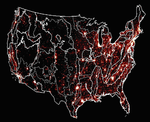
Distribution of eco-regions around the continental
U.S super-imposed on night lights data showing
the level of urbanization.