Power Outage in Afghanistan as Seen by DNB
The economic and humanitarian crisis in Afghanistan following the withdrawal of the US Armed forces, which was completed on August 31st, 2021, can be viewed from ‘space.’ Areas which were lit before become dimmer or become completely dark because of the loss of electricity.
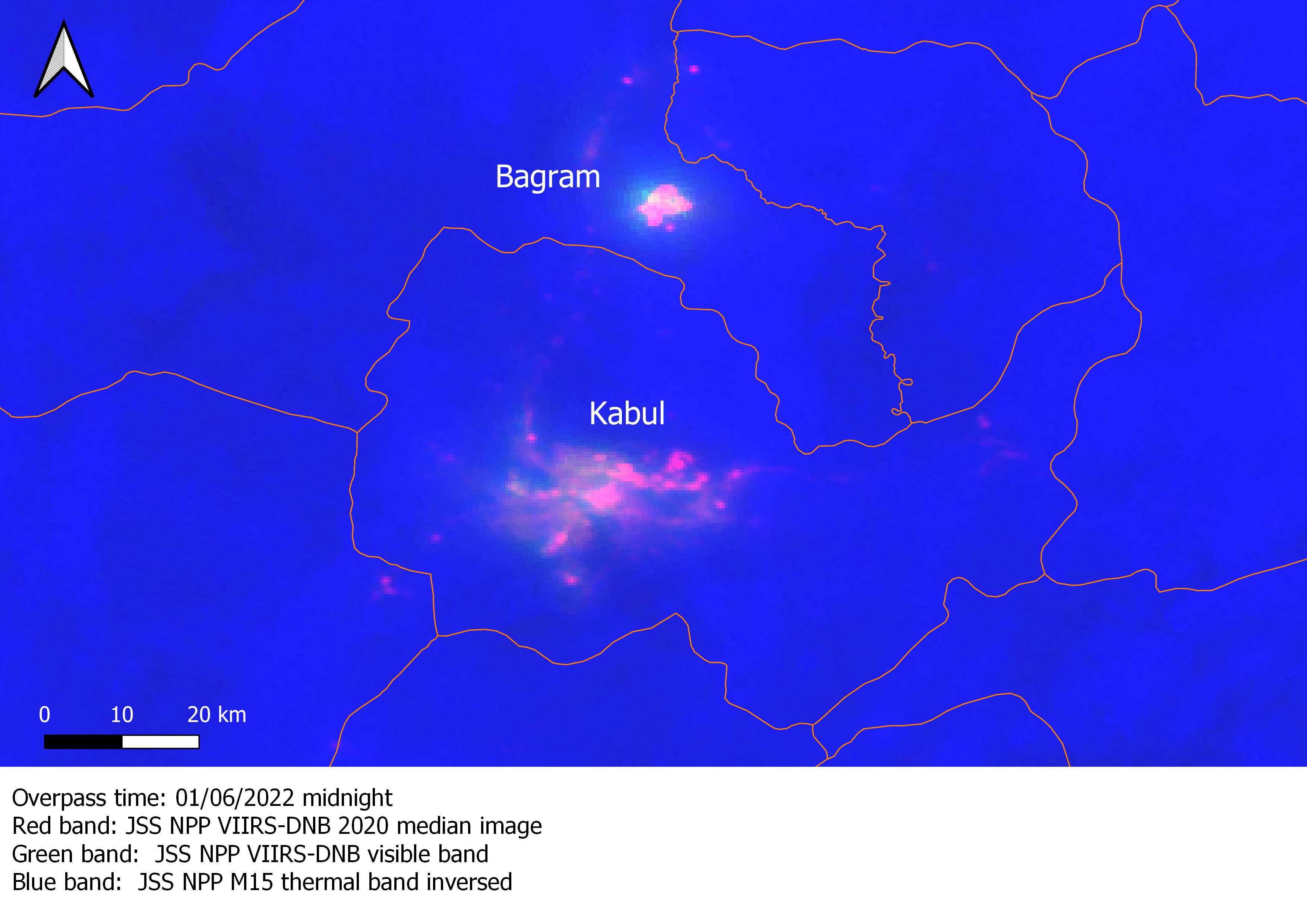
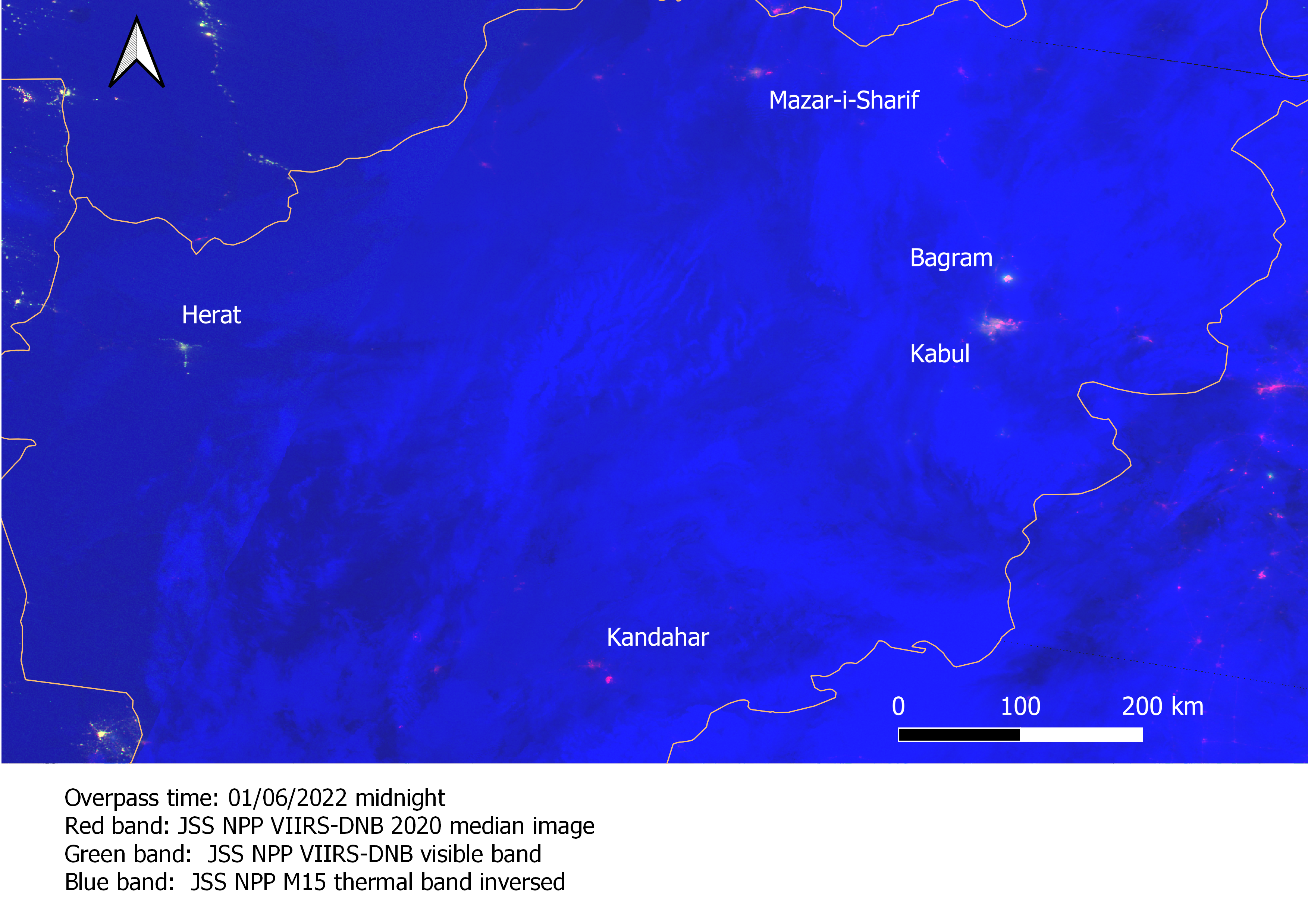
The daily and monthly Visible Infrared Imaging Radiometer Suite (VIIRS) nighttime images processed by the Earth Observation Group, Payne Institute for Public Policy, provide a unique view of this phenomena. In the images below the daily images of four days in the month of January 2022 have been compared with the annual median image of 2020.
The image of January 6th shows dimmer areas in ‘red’ in the major cities of Kabul, Kandahar,
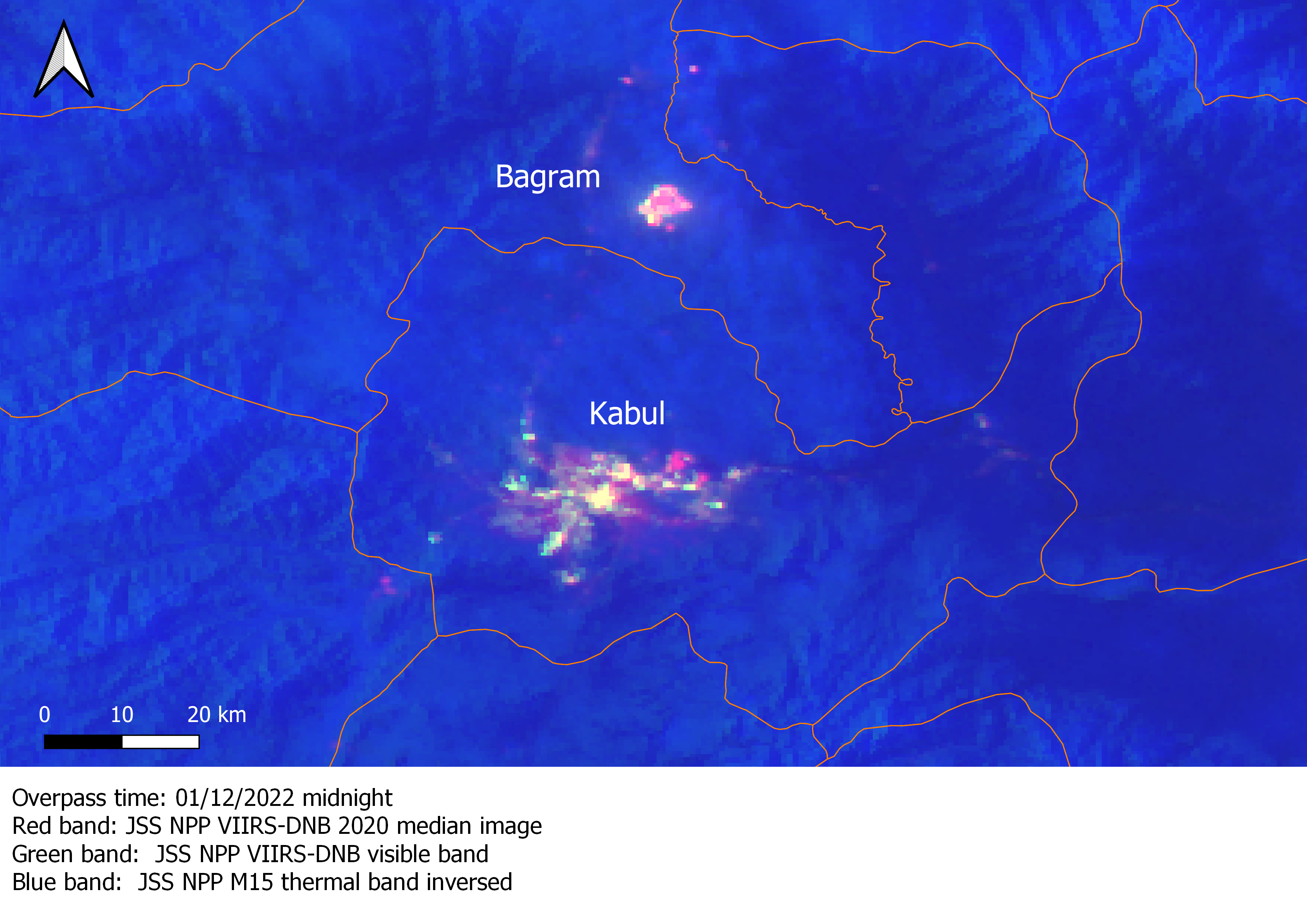
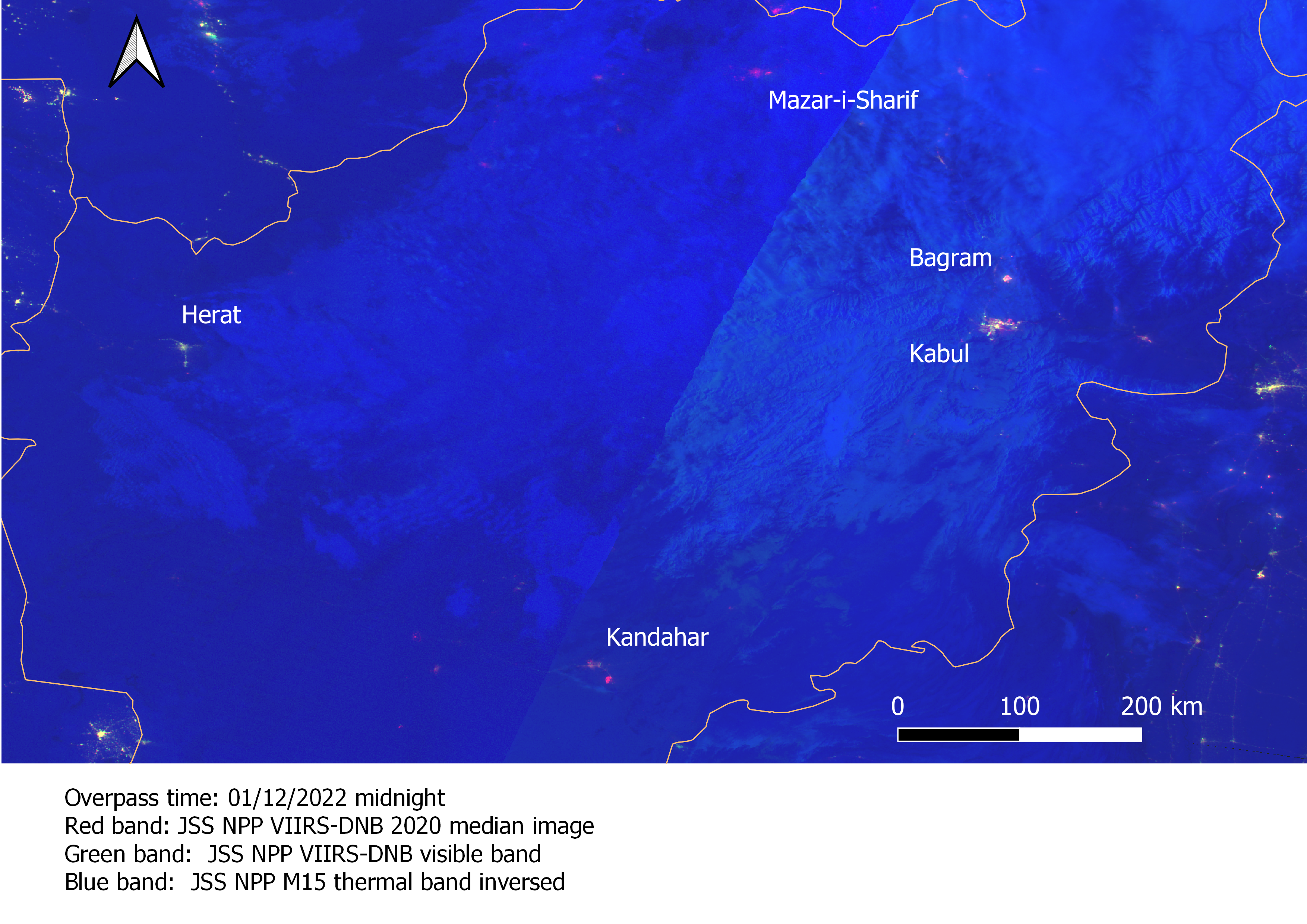
Mazar-i-Sharif, and the town of Bagram, where the US had established its largest military outpost at the Bagram air base. In the image of January 12th, more of ‘yellow’ shows that lights are back to their normal’ levels in areas of Kabul, and western parts of Bagram. However, eastern part of Bagram (location of Bagram air base) Kandahar and Mazar-i-Sharif continue to be dimmer than usual.
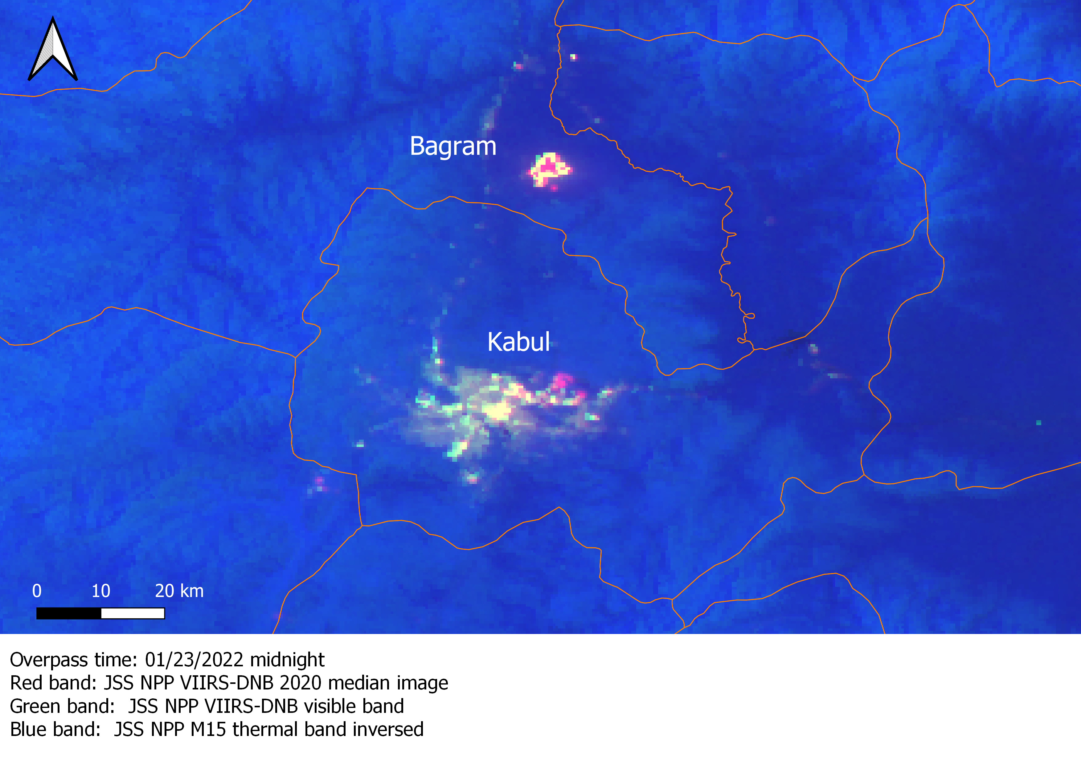
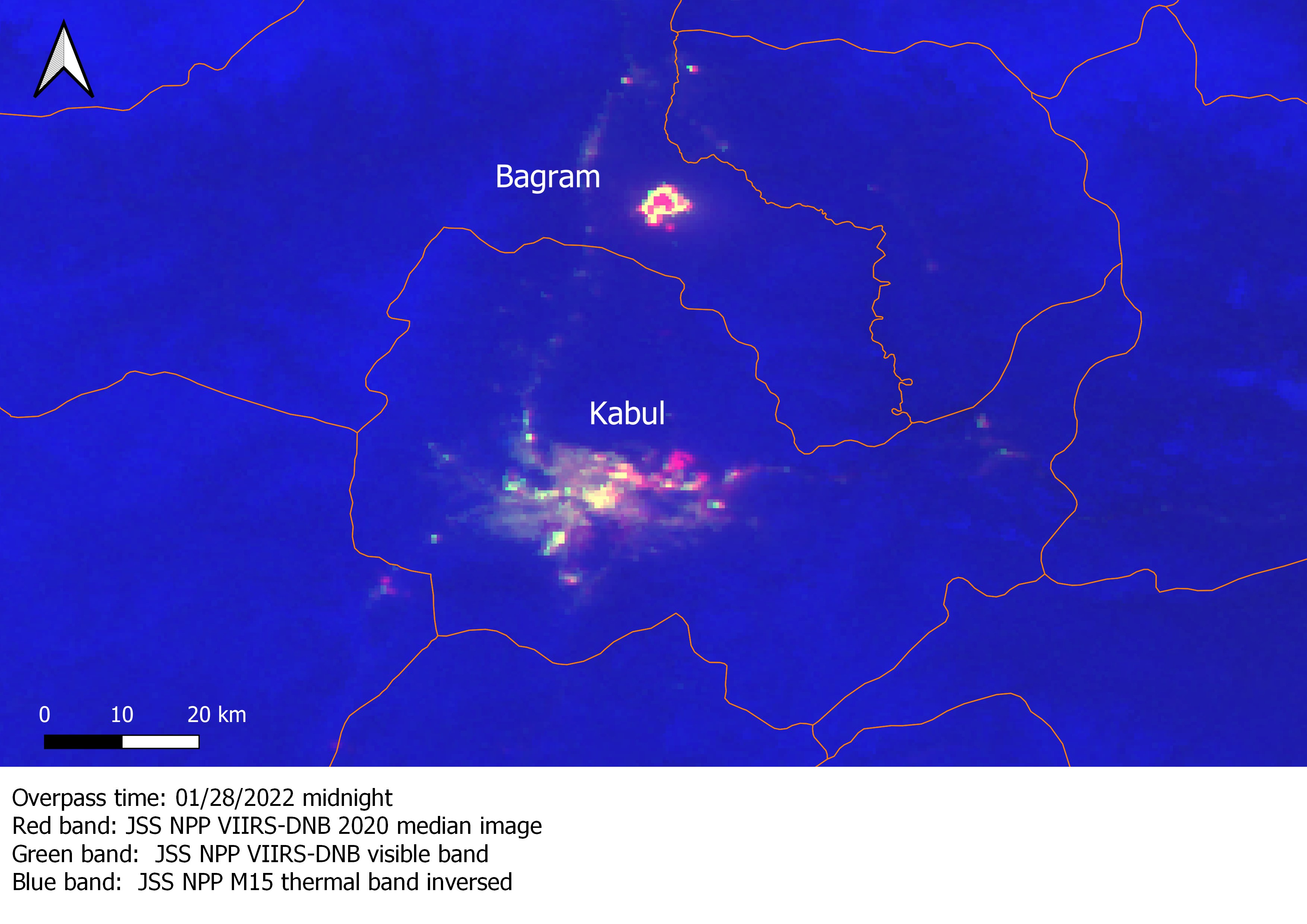
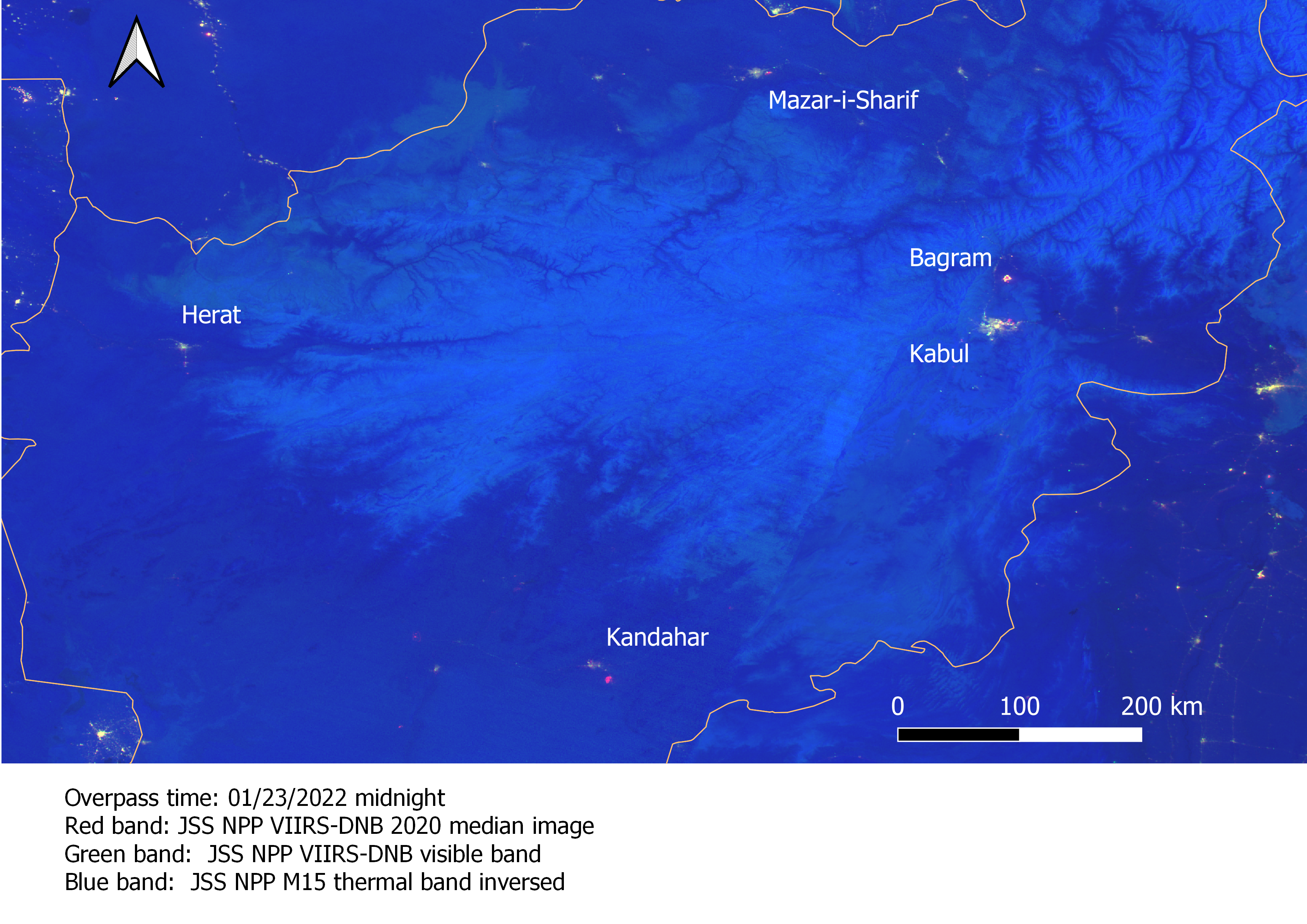
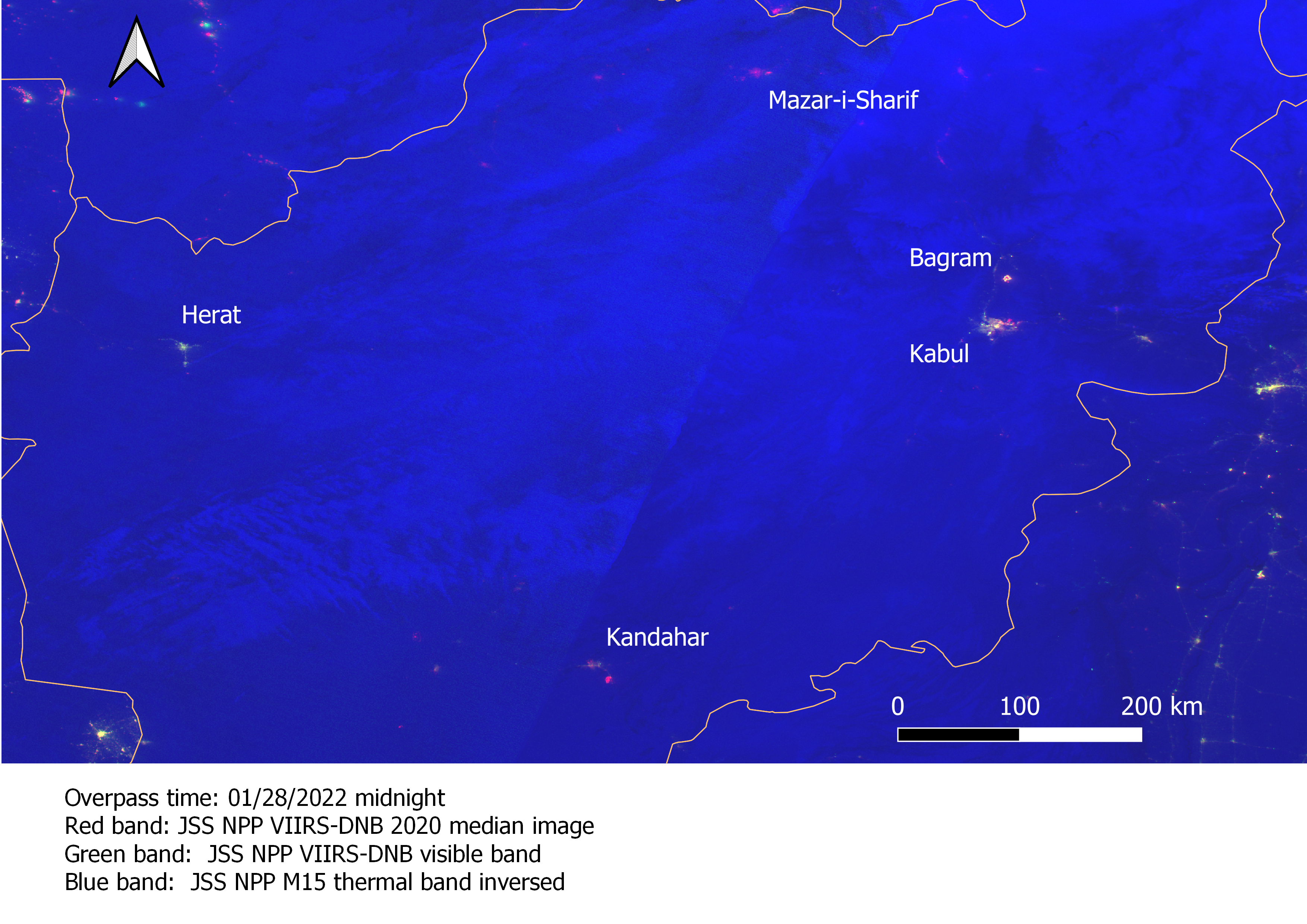
In the image of January 23rd, more ‘yellow’ areas are seen in all the cities and Bagram. However, in the image of January 28th, Kandahar and Mazar-i-Sharif again appear dimmer compared to normal levels of lighting. It is to be noted that the western city of Herat had ‘normal’ levels of lighting in all the daily
images. Moreover, the areas which appear dimmer in all the images are linked to the major airports in Afghanistan – the Bagram air base (as mentioned before), the Hamid Karzai International airport in Kabul (west), the Ahmad Shah Baba International airport, Kandahar (south), the Mazar-i-Sharif
International airport (north). The latter four images zoom into Kabul and Bagram.
Credit
When using the data please credit the product generation to the Earth Observation Group, Payne Institute for Public Policy, Colorado School of Mines.